National Highway 543 (India)
 | ||||
|---|---|---|---|---|
Map of the National Highway in red | ||||
| Route information | ||||
| Length | 563 km (350 mi) | |||
| Major junctions | ||||
| North end | Shahdol | |||
| South end | Bramhapuri | |||
| Location | ||||
| Country | India | |||
| States | Madhya Pradesh, Maharashtra | |||
| Highway system | ||||
| ||||
National Highway 543, commonly referred to as NH 543 is a national highway in India.[1][2] It is a spur road of National Highway 43.[3] NH-543 traverses the states of Madhya Pradesh and Maharashtra in India.
Route
- Madhya Pradesh
Shahdol, Dindori, Mandla, Nainpur, Lamta, Balaghat - Maharashtra Border.[1][4]
- Maharashtra
Madhya Pradesh border - Rajegaon, Dhamangaon, Rawanwadi, Gondia, Amgaon, Deori, Korchi, Kurkheda, Desaiganj(Wadsa), Bramhapuri.[1][5]
Junctions
 NH 43 Terminal near Shahdol.[1]
 NH 45 near Dindori.
 NH 30 near Mandla.
- near Balaghat
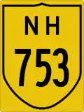 NH 753 near Gondia.
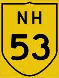 NH 53 near Deori.
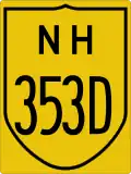 NH 353D Armori near Bramhapuri.
See also
References
- ^ a b c d "New national highways notification dated June, 2016" (PDF). The Gazette of India - Ministry of Road Transport and Highways. Retrieved 12 August 2018.
- ^ "State-wise length of National Highways (NH) in India as on 30.06.2017". Ministry of Road Transport and Highways. Retrieved 12 August 2018.
- ^ "New Numbering of National Highways notification - Government of India" (PDF). The Gazette of India. Retrieved 12 August 2018.
- ^ "Declaration of state roads as new national highways in Madhya Pradesh" (PDF). Public Works Department - Government of Madhya Pradesh. Retrieved 12 August 2018.
- ^ "New national highways notification dated Jan, 2017" (PDF). The Gazette of India - Ministry of Road Transport and Highways. Retrieved 12 August 2018.
External links


Secondary routes of National Highway 43 | ||
|---|---|---|
| Route in States of India | | |
| Secondary Routes of NH 43 | ||